Route 01
A limestone shelf, a creek that keeps running, and six ways down to it
This is the route every list in this city puts first, and for once the lists are right, with two qualifications that no list mentions.
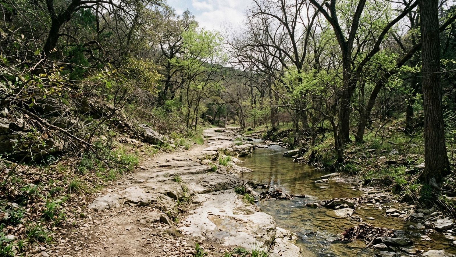
The trail runs along a creek in a limestone canyon that cuts through the middle of the city. What makes it the best walk here has nothing to do with the scenery, which is genuinely fine, and everything to do with two facts: the canyon walls hold shade for most of the day, and the creek is spring fed, so it keeps water long after the rain has stopped.
For an animal in Central Texas those two facts are the entire argument.
The walk
Three and four tenths of a mile from the upper access down to the wide crossing and back. An hour and forty at the pace of a dog who reads every twenty yards, on a March afternoon at seventy one degrees under high cloud.
The path is a shelf: flat limestone with the creek below on one side and the canyon wall above on the other. In three places it drops to the water and climbs back out, and those three places are where the stone is worst.
Shade, hour by hour
The canyon runs roughly east to west, which means the shade behaves in a way worth planning around.
| Hour | Where the shade is |
|---|---|
| Before 10 | Nearly the whole route, both sides |
| 10 to 1 | The north bank, which is the side the trail is on for most of it |
| 1 to 4 | Patchy, and the open shelf sections have none |
| After 4 | Returns, and the last hour before dusk is the best of the day |
In March that table is a convenience. In July it is the difference between a walk and a bad idea, and the honest advice for July is the first hour after sunrise.
The six ways to water
Counted on this walk, from the upper access down: a shallow gravel bar at a quarter mile, a step down at the first bend, the pool below the first crossing, a long gravel edge in the middle third, the wide crossing itself, and one narrow slot at the far end that a confident dog uses and a careful one refuses.
That is six in three and a half miles, which is more water access than any other route in this journal by a wide margin.
The stone
Limestone underfoot is fast, hard and unforgiving in one specific way: where water has run over it, it grows a film that stays slippery for days after the water has gone. The film is invisible when dry and the patches are pale rather than dark.
A dog on a short lead on wet limestone will slip, and so will the person holding it. This is the one route in the index where a lead that gives is worth more than a lead that holds.
Roots cross the shelf in the shaded sections, and they are the other thing to watch. Not a hazard so much as a rhythm: they arrive about every ten feet for stretches of thirty yards.
The signs
Both access points carry the same posted sign requiring a lead. It is transcribed here rather than interpreted, because what a sign means legally is not this journal's subject: it says a lead is required, and this record reports that.
What it is like in the wrong season
By late August, in a dry year, the creek is a chain of green pools with no flow between them. The pools are still water an animal will happily stand in, and they are also still water, which is a difference worth a thought.
The shade holds up better than the water does. If you come in that season, come at dawn, plan for pools rather than a creek, and carry more than you think.
Before you go
- Walked
- 8 March 2026
- Distance
- 3.4 miles
- Shade
- two thirds, best before noon
- Water
- continuous, reachable in six places
- Surface
- limestone shelf and root
- Signed
- lead required, posted at both ends
- Best hours
- any hour in March, before ten from June
The limestone is slick where water has been over it, and it stays slick for days after the level drops. The shelf sections have no soft edge: a dog that pulls on a lead will find that out on stone. Water here is a creek, not a tap, and it runs low enough by late summer to become pools rather than flow.